Extreme weather poses a growing threat to Canadians, but government officials aren’t improving our readiness quick enough to keep pace, says a University of Waterloo researcher who grades preparedness.
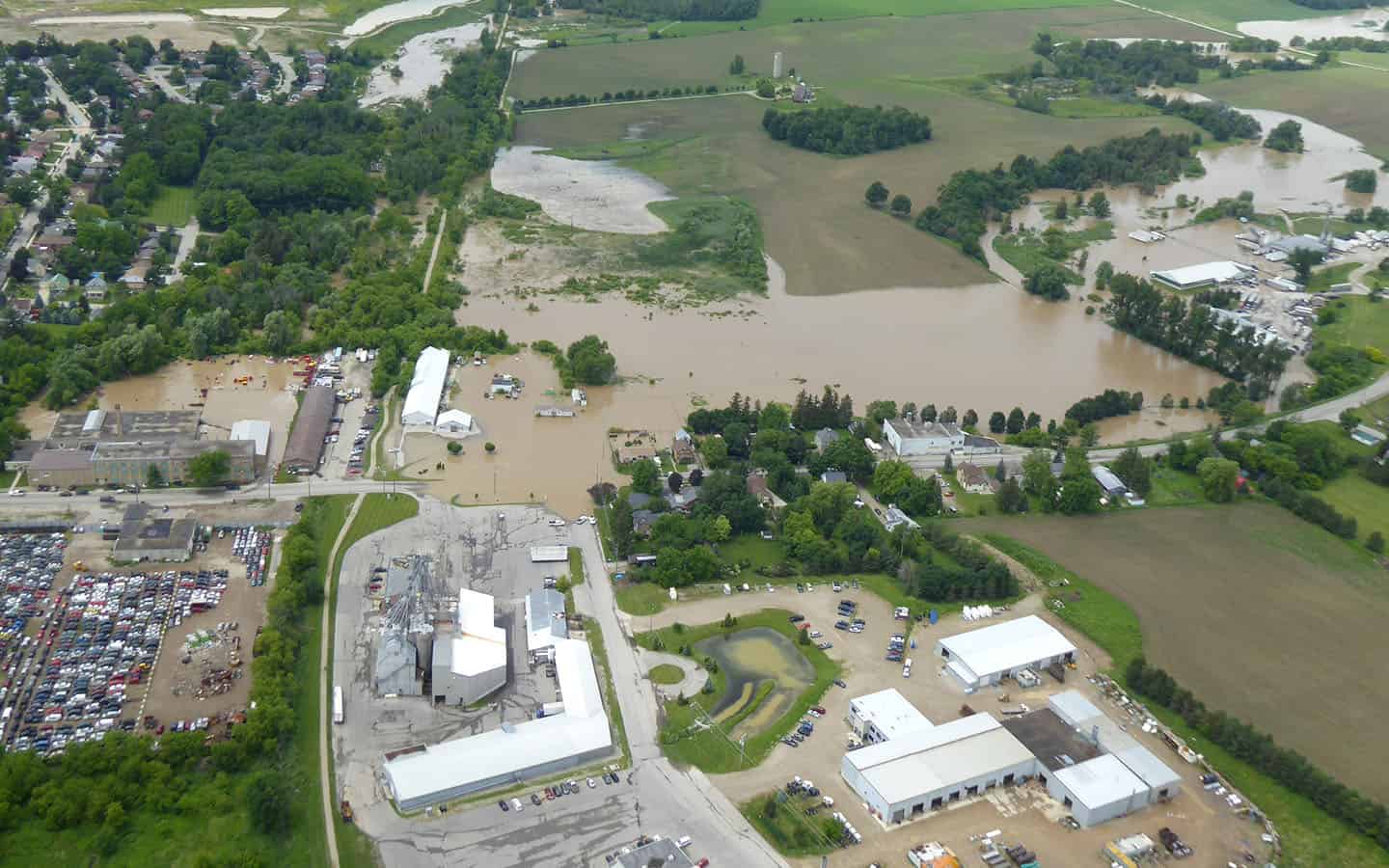
The biggest threat is microburst storms that can bring 80 to 150 millimetres of rain within a two- to four-hour period, said Prof. Blair Feltmate, noting such storms can overwhelm sewer systems, causing them to fail and back up into the basements of homes and businesses.
In many areas, including the townships, there’s the added risk of rivers and creeks breaching their banks, with preparations for such issues falling to agencies such as the Grand River Conservation Authority.
The country is already seeing storms of greater intensity, increasing the risk of floods, said Feltmate.
Head of the Intact Centre on Climate Adaptation (ICCA) at UW, he first conducted a readiness study in 2016, grading the preparedness of each province, territory and the country as a whole. The study had researchers interview 139 government representatives from provincial and territorial levels on managing floods, climate-related risks, and emergency services to calculate grades. The study was conducted again for 2019 to see how, if at all, preparedness improved.
“Some provinces did not do as well [while] others were flat, and then several improved for Canada as a whole. We went from an overall score of C- to a C over the period of 2016 to 2019, so that’s sort of a good news/bad news story,” said Feltmate. “The good news is at least we went in the right direction [for the country as our grade improved], the bad news for the country as a whole, we’re not moving – at least in my view – quickly enough in a forward direction to mitigate flooding.”
Preparedness for provinces and territories was evaluated based on factors such as the state of readiness of flood plain maps in the country, land-use planning relative to the flood risk, efforts to retain natural infrastructure, flood safety and preparedness of critical infrastructure and public health and emergency management capacity to limit flood risk.
The latest study shows many provinces had grades that stayed flat, not improving over the three-year period. Other provinces and territories saw their grades drop to varying degrees – Ontario went from a B- in 2016 to a C in 2019. Only a few provinces/territories saw an increase in the grade during the period in which the two studies were conducted with the most significant results coming from PEI improving from a D to B- and Yukon going from a D+ to B-.
Feltmate says Ontario’s score came from a lack of updated flood risk maps. He also says stronger enforcement is needed with regards to not building in areas where the risk of flooding is higher.
“We need stronger enforcement in reference to not building in areas that are vulnerable to flooding. And these are the two areas in particular [the] lack of being up to date on flood risk maps and not being rigorous enough and in reference to enforcement to not build an area vulnerable to flooding, those were two primary areas of weakness,” he said.
Feltmate adds that Ontario’s strengths include a strong early warning system, more retention of natural infrastructure and a better documentation of the “preparedness of critical infrastructure to its vulnerability for flooding.”
In the GRCA watershed, a high level of flood readiness is maintained, said agency spokesperson Cameron Linwood, noting the study says the areas most at risk are not covered by conservation authorities.
The GRCA works with municipal partners to ensure a high level of preparedness with regards to riverine flooding, he added.
Linwood says the risk of flooding in the Woolwich and Wellesley areas are always there, mainly by riverine flooding in floodplains.
“Like many communities throughout the Grand River watershed, these communities have properties and infrastructure located within the floodplain that are impacted by riverine flooding. The primary risk to these areas include annual spring flooding due to snowmelt as well as ice jam-related flooding, which can often occur during rapid spring melt or rainfall events. These communities are also susceptible to extreme weather events such as those which occurred in June 2017 and January 2020 where high volumes of rainfall were received during a condensed period of time, resulting in flooding. This type of event can occur at any time of year,” he said.
To limit the flood risk in the townships, Linwood says things like monitoring weather conditions and river flows, controlling development in flood prone areas, and operating multipurpose dams and reservoirs to store water and reduce flood peaks are all done by the GRCA to manage the risk of flooding.
The UW study will be conducted again in 2023-24. Based on the current trajectory, Feltmate expects the overall grade of the country to improve to a C+, which falls short of what’s needed, he said, adding he hopes the country can speed up and adapt to the climate changes we’re experiencing.


