
Autumn’s arrival coincided with some cool, rainy weather, but we can probably expect a milder-than-normal fall, at least for the time being.
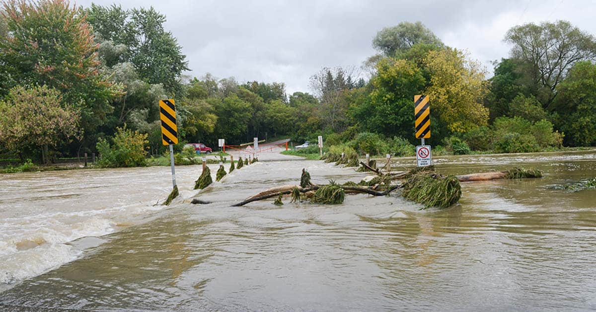
The at-times-heavy rainfalls last week caused some small flooding events in the area – the low-level bridge in St. Jacobs was completely under water at times, for instance – and the wind took down some branches, but the weather was largely low-key.
“There has been some flooding in some areas roads, and one of the reasons for that is because the amount of rain that we got in August and into September was more than we normally would see,” explained David Phillips, senior climatologist for Environment Canada.
“It’s not what you’d call a gully-washer. If you got that amount of rain in two hours, well, then there would have been a lot of more flooding in basements. It was steady. It was hard at times. Rates were up, but it was over a 48-hour period. We often get more rain in September than any other month because of remnants of hurricanes or storms or what have you, but this was just one of the characters of storms that we’ll see more of in the future. Therefore, you have more water filling ditches and creeks and streams and overrunning culverts.”
The fall is set to be a milder and drier season as residents begin to watch the leaves change, noted Phillips.
“We see temperatures being warmer than normal, but not July warm. We’re not talking about return to the muscle shirt or tank top – it’s sweater weather. Typically, we start getting frost late-September to the middle of October in southern Ontario. We don’t normally see snow until Remembrance Day. Our models are saying that because of all of the heat that we had in the rivers and the lakes, the temperatures are warmer than normal in Ontario, by one and a half to two degrees,” he said, noting the summer heat is still paying dividends.
“In the Waterloo area there was 15 days where the temperature got above 30 [degrees], we normally would see eight. It was warm at times, it wasn’t in July but it was in August and so a lot of that residual heat will keep fall warmer and milder than normal.”
Phillips predicted the peak of the leaf colour change won’t happen for another three weeks – storms haven’t impacted the change but heat has slowed it down. He cautioned residents to not plan their leaf-viewing trip too far in advance, as fall weather can shift quickly.